The heritage projectPlaces
Rooted in Rarh Bengal
Sourced from the Aguri Heritage project.
https://aguri-heritage.in/geography
Original project material: all rights reserved. Other material retains its own rights. Copyright & reuse
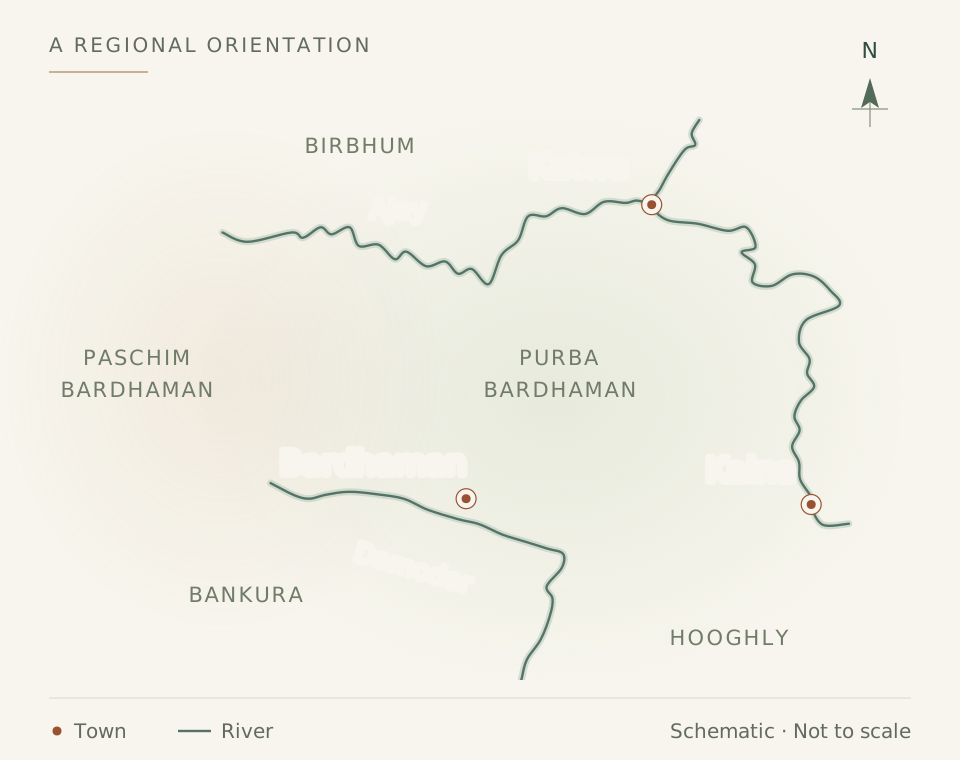
Bardhaman and the neighbouring districts connected with Aguri history and community life.
Last updated:
Cite this page
Aguri Heritage. “Rooted in Rarh Bengal.” Last updated: . https://aguri-heritage.in/geography.
Citing this page does not grant permission to republish it. Copyright & reuse.
Bardhaman and its neighbouring districts form the historical heartland of Aguri community life. Their villages, river valleys and changing towns connect family histories with the wider story of Rarh Bengal.
The regional heartland
Reference accounts locate the Aguri community particularly in Bardhaman, Birbhum, Bankura and Hooghly. These are broad historical associations, not exclusive boundaries or a census of today’s population.[1] An anthropological study of Rarh, drawing on the 1931 census, likewise places agriculturist castes “such as Sadgop, Goala, and Aguri” in undivided Bardhaman and in some parts of Birbhum (Mukhopadhyay 2026, p. 7).[2]
More than red earth
Rarh is often evoked through red earth, but the landscape also includes river valleys and fertile alluvial plains. The official account of Purba Bardhaman places it principally between the Ajay, Bhagirathi–Hooghly and Damodar rivers and describes the variety of its landforms.[3]
The western district’s historical account associates Gopbhum with the land between the Ajay and Damodar. Places such as these provide context for the competing histories of regional power and community identity.[4]
Reading old place-names
| Name in the record | How to read it |
|---|---|
| Burdwan / Bardwan / Bardhaman | Different English renderings of the district or town name. Check which meaning the source uses. |
| Undivided Bardhaman | An older administrative district. Purba and Paschim Bardhaman were created on 7 April 2017.[4] |
| Calcutta / Kolkata | The journal’s imprint uses the historical city name Calcutta. It is retained when describing that imprint.[5] |
| Rarh / Radh / Radha | Variant renderings of a historical region, not a present-day administrative district.[4] |
Burdwan in the historical census record
Dutta reproduces the following figures in Table 13.1, p. 305, drawing on Hunter and the historical censuses. They show the concentration of the recorded Aguri population in Burdwan.[6]
| Year | Bengal | Burdwan |
|---|---|---|
| 1872 | 70,606 | 59,887 |
| 1881 | 78,349 | 57,272 |
| 1911 | 79,272 | 66,551 |
| 1921 | 68,816 | 59,949 |
These are historical enumerations under the geographical and classificatory conventions of their sources. They are not present-day population estimates, and changes between rows should not be read as a simple demographic trend without examining those conventions.
Following families across places
Dutta’s examples connect specific families and villages: the Hazras of Anguna in the trans-Damodar region, the Panjas of Sathinandi, the Tahs of Palitpur, the Roy Chowdhurys of Chaitanyapur and the Sahana family of Bankura (pp. 308–310).[6] Read about family enterprise and landholding.
Village fieldwork adds to this picture. At Kshiragram, in the Mangalkot block, Masahiko Togawa counted Jana and Suta Aguri households and title-defined lineages; at Musharu, Salini Saha found Ugra Kshatriyas the dominant farming community.[7][8] In Raina I block, south of the Damodar, Arild Engelsen Ruud studied a village he calls Gopinathpur, where Aguris were the dominant landholding caste in 1993; he disguised its name, so it cannot be placed on a map (pp. 16–17).[9]
The villages were linked to one another. Each month the Kshiragram temple calls the Aguris of Eruyar, Nasigram, Kusumgram, Kurmun, Kaligram and Majigram, which Togawa describes as Ugra Kshatriya-dominated villages around the Mangalkot area (pp. 44, 86). A Raychaudhuri lineage chart reported by Togawa traces one family from pargana Dhenya to Eruyar in about 1746–47, to Kshiragram in about 1774–75 and to Chaitanyapur in about 1794–95, an example of families moving between neighbouring villages (pp. 148–149).[7]
Census figures show the scale. In 1901 Aguris were 11.1 per cent of the population of Raina, and in 1921 7.6 per cent of Burdwan district, a substantial minority rather than a majority (Ruud, p. 123).[9]
Village records, dated family documents and contributed oral histories could make the geographical story more precise. A place index should distinguish where someone was born, lived, held land, worked or published; those locations are not necessarily the same.
Notes & sources
- “Aguri (caste)” — reference article and bibliography. The listed community connections are attributed to this article. Life and career accounts are separately sourced; the underlying books have not all been checked. Source details
- Kanchan Mukhopadhyay, Uneven Terrain: Society and Foodways in Rarh Bengal (2026). Only the publisher’s preview (front matter, chapter 1 and references) was read. The single Aguri mention is a regional census observation; none of the four study villages is in Bardhaman. Source details
- Purba Bardhaman district: Geography. Web page consulted 13 September 2026. Used for landscape and present-day orientation. Source details
- Paschim Bardhaman district: History. Web page consulted 13 September 2026. Historical district boundaries must not be equated with current ones. Source details
- Ugrakshatriya-Pratinidhi, Volume I (1298 Bangabda). Owner-supplied PDF. Complete electricity essay (printed pp. 12–23) and first editorial’s opening-page extract translated against the scans; selected reading notes also available. Bengali OCR remains unreviewed. The contents leaves (scans 2–3) were re-read against the images on 8 October 2026 for the titles and authors cited on the Culture page. Source details
- Achintya Kumar Dutta, “Prosperity, Dominance, and Social Mobility: Emergence of a Mobile Caste in Colonial Southwest Bengal” (2023), pp. 297–324. Complete chapter, including endnotes and references, read directly in the supplied book. Page references use its printed pagination. Origin hypotheses remain attributed to the author. Link opens the publisher’s book record. Source details
- Masahiko Togawa, An Abode of the Goddess: Kingship, Caste and Sacrificial Organization in a Bengal Village (2006). Full book read. The study describes one village in 1994–95 and the author’s reconstruction of earlier practice; it is not a survey of all Aguri settlements. Source details
- Salini Saha, “Endangered cobras and conservation politics: Exploring multispecies encounters in agrarian landscapes of West Bengal” (2026). Original article read; pp. 5 and 7 checked as page images, and pp. 6, 11–12 and 14 in the extracted text. Describes a shared village culture, not practices exclusive to Aguris. The thesis is listed separately (Saha 2023). Source details
- Arild Engelsen Ruud, Poetics of Village Politics: The Making of West Bengal’s Rural Communism (2003). Chapters 2–5 read in the supplied scan, with all Aguri passages located by full-text search. Village and personal names in the book are the author’s; the villages are deliberately disguised and should not be identified with real places. Source details
Page views: